Územní plán a přijatá změna č. 1
V této části najdete všechny výkresy Územního plánu obce Vestec po vydání změny č. 1 a příslušné texty. Územní plán po vydání změny č. 1 nabyl účinnosti dne 03. 10. 2026.
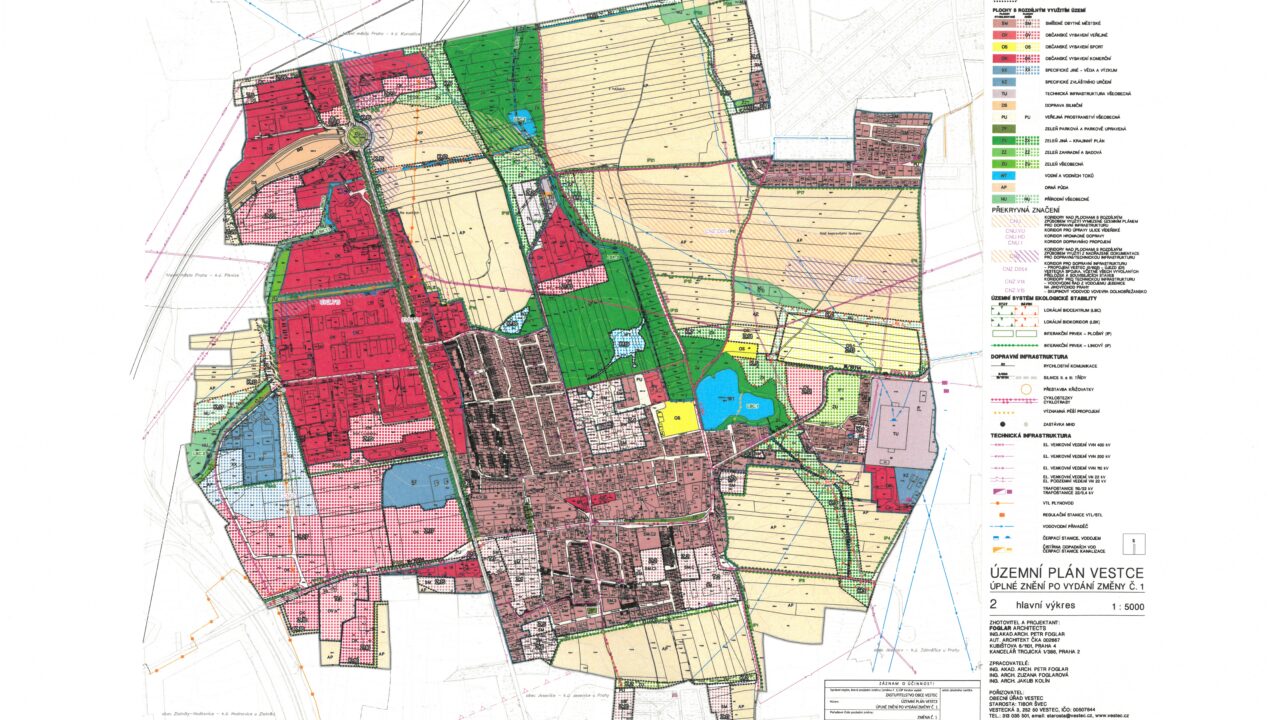
Územní plán Vestce
Územní plán Vestce byl vydán 31. ledna 2018 a účinnosti nabyl dne 16. února 2018.
Úkony předcházející přijetí změny č. 1 územního plánu Vestce:
1. Zpráva o uplatňování územního plánu Vestce
is drawn up on the basis of the provisions of Sections 106 and 107 of Act No. 283/2021 Coll., as amended, for the period from the date of its issue on 31 January 2018.
The final version was approved by the Vestec Village Board on April 9, 2025.
2. Vystavení Návrhu změny č. 1 územního plánu Vestce a Vyhodnocení jeho vlivů na udržitelný rozvoj území
This change was discussed publicly on 4 November 2025 at 15:00 in the BIOCEV lecture hall (Průmyslová 595, Vestec).
Not later than 15 days from the date of the public hearing, i.e. until 19 November 2025, anyone may submit their comments in writing to the contracting authority, the Vestec Municipal Office. Comments submitted after the deadline or submitted in matters that have been decided in the superior spatial planning documentation shall not be taken into account. In addition to the general requirements of the submission under Act No. 500/2004 Coll., the Administrative Code, as amended (hereinafter referred to as the "Administrative Code"), the comment must contain a statement of reasons and a definition of the area affected by the comment (Section 97(2) of the Building Act).
No. 1 of the Vestec Urban Development Plan cannot be objected to under Part Six of the Administrative Code.
In the attached files you will find the discussed changes for the drawings marked as "substantive", i.e. the annexes marked with serial numbers 09 and 10. The drawings marked "conversions" reflect the new rules for colour coding of individual zones in the existing zoning plan.
Draft Amendment No. 1 to the Vestec Master Plan and Evaluation of its Impact on the Sustainable Development of the Territory
Původní územní plán Vestce
Původní územní plán (bez změny č. 1) platil od února 2018 do 2.10.2026. Dokumenty a informace o tomto původním územním plánu lze nalézt na samostatné stránce Územní plán Vestce do 10/26.
Před pořízením územního plánu v roce 2018 platila verze územního plánu od roku 2002 do ledna 2018. Schválením nového územního plánu pozbyl tento územní plán platnosti. Informace ke „starému“ územnímu plánu vám poskytnou pracovníci na stavebním oddělení Městského úřadu Jesenice nebo na Obecním úřadu Vestec.
Strategic Development Plan of the Municipality of Vestec (approved 16.12.2020)
The Strategic Plan is a conceptual document which, based on a detailed analysis of the territory (the current development of the municipality, the demographic and economic situation of the municipality, the weaknesses and strengths of the municipality, etc.), defines the main directions of the municipality's development within a set time horizon (for the years 2021-2025). The strategic plan sets out the objectives, priorities and specific measures for the main areas of life in order to achieve these objectives. The strategic plan also aims to define and coordinate the common interests of the municipality, the inhabitants of the municipality and business entities in order to achieve the overall prosperity of the municipality. The strategic plan will also serve as a basis for grant applications.
Green Spine as part of the Landscape Plan (2014)
A unique project that boldly connects previously separate biocentres and non-functioning biocorridors of our municipality in one continuous landscape element comprising several retention basins, mature vegetation or floodplain meadows. It gives space for wildlife in the immediate vicinity of human dwellings, and it gives people space for recreation and relaxation in the midst of nature.
Read more about The green backbone of Vestec